


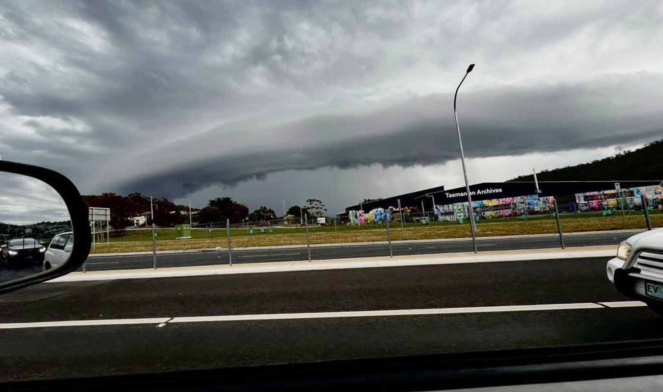
Social media has been flooded with photos of a ‘UFO-looking’ cloud that appeared over Hobart on Wednesday.
The cloud appeared as a storm front moved across greater Hobart, accompanied by approximately 10,000 lightning strikes and a torrential downpour of 40mm of rain in one east coast in just one hour.
A spokesperson from the Bureau of Meteorology said the clouds are referred to as “shelf clouds” and typically appear ahead of approaching thunderstorms.
“Although more common on the mainland, shelf clouds like the one we saw yesterday are rare around Hobart, usually occurring every few years or so,” the BOM say.
“Cool, dense air underneath the approaching thunderstorm forces the warm and humid air ahead to quickly lift. As the humid air is lifted, it cools and condenses into an arc-shaped cloud called a shelf cloud”.
“The rising humid air can be very turbulent and can generate dramatic undulating cloud ahead of the storm.”
“The air then rises and cools so rapidly that chunks of ice quickly form and can be suspended kilometres up in the sky.”
“A slight blue or green tinge to a storm cloud (as we saw yesterday) often indicates a large amount of ice and hail suspended high up”.
Read the full article here


